Introducing ‘Seismic Resilience as a Service’ to New Zealand
What is EQRNet?
EQRNet is ‘Seismic Resilience as a Service’; a new generation solution to deliver defendable, evidence-based decision-making information which increases certainty, and reduces risk.
EQRNet is developed and operated by Canterbury Seismic Instruments Ltd (CSI). With Christchurch City Council as the anchor user of the network, CSI have created an affordable model that encourages uptake by lease holders, facility managers, engineers, building owners, Civil Defence and Emergency Management, homeowners, and the public to safeguard people and assets – and the ability to provide a wealth of valuable data for industry development and academic research.
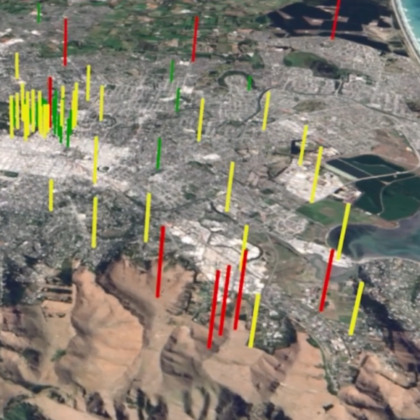
A 10-sensor trial of EQRNet was installed in November 2017 demonstrating the variability in earthquake source proximity, direction, and local ground conditions means that earthquake shaking levels across a city like Christchurch are hugely variable.
Our existing GeoNet stations are an important tool for measuring earthquake shaking, but they are too few and at too greater spacing to provide an accurate city-wide shaking map.
The first implementation phase provides a dense seismic network with more than 150 sensors across Christchurch combined with best-practice engineering processes to manage our earthquake response in real-time – safeguarding communities, employees, and our many assets above and below ground.
Why are we investing in EQRNet?
The recent impact of earthquakes in Canterbury, Marlborough, and Wellington have not only caused major loss of life, but economic losses well over $50B. With these impacts, and the growing prevalence of risk-based insurance premiums, there is a requirement for local and central government agencies, and emergency response teams to capture a greater amount of quality information for defensible decision-making.
Where will the sensors be installed?
The sensors will be positioned at 100-200m intervals. The majority will be installed in traffic signal boxes and the remaining sensors will be placed in Council facilities and other important sites.
EQRNet features
- Sensor stations positioned within 200m of each other allows EQRNet to confidently and accurately estimate shaking between sensors.
- Accurate ground shaking data enables rapid assessment for individual buildings – allowing facility managers and building wardens to make informed on-the-spot decisions about evacuation.
- Individual building shaking intensity relative to Building Code provides information on potential structural damage to engineers for their detailed building assessment.
- Genuine mass coverage for visualisation of the number and extent of area of affected buildings; rapid, accurate and defensible emergency management decisions will result in more accurate ‘red zone(s)’.
- At a glance, ascertain the priority assessment (triage) for below-ground infrastructure.
- Service model based on many years of seismic monitoring experience.
- Eliminates equipment ownership issues therefore no maintenance or end-of-life replacement funding hurdles.
- Simple, no-fuss equipment installation, typically less than 30 minutes for each sensor.
- Reliable, simple cell communications from sensor to network base. No IT system integration problems.
EQRNet Services
EQRNet combines a dense sensor network (>150) and established, trusted best-practice engineering processes to remove the capital burden on councils, building owners, and leaseholders by delivering seismic resilience products as a service:
- EQRLite Service; real-time evacuation guidance for facility managers and building wardens
- EQRMax Service; real-time structural information for building owners and engineers
- EQRMap Service; real-time area-wide shake map information for emergency response teams
- EQRPeople Service; real-time area-wide shake map summary for the public