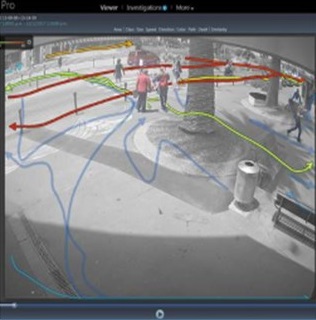
Knowing how many people are out and about in the streets of the city is powerful!
The objective of this trial is to convert our current 20th century method of counting pedestrians to a smarter, more efficient method that uses modern technology and approaches.
Pedestrian counting already occurs in the city and is typically done by a group of university students with ‘clickers’ counting and taking notes about peoples’ direction of travel and dwell time over the summer holidays.
The Smart Christchurch team identified an opportunity to create a public-private collaboration that uses existing technology in the city to provide a reliable and consistent, automatically-generated dataset to a wider range of stakeholders.
Why do we count pedestrians?
Christchurch will gain powerful insight from understanding how people are using our emerging city:
- What lanes do people travel through?
- Where do they like to sit and rest?
- Which precincts, facilities, or events attract the most people?
What technology are we using?
The Smart Christchurch programme uses existing cameras where possible, so that trial costs are minimised.
The cameras being used for this trial are owned by private companies and developers and public agencies such as Christchurch City Council (CCC), Christchurch Transport Operations Centre (CTOC), Development Christchurch, and Christchurch NZ.
The trial is being delivered in partnership with VIP Security Limited. They are the point of aggregation for the camera footage and also the providers of the software that counts people and other traffic modes such as cars and bicycles.
Is our privacy protected?
Yes! The Smart Christchurch team have assessed the privacy impacts for this trial and written a privacy policy to help explain what we are capturing (no facial recognition – just shapes only) and how we are protecting the data.
To minimise human intervention and alleviate privacy concerns, internationally reputable software designed to identify pedestrian, bikes, and cars (multi-modal analysis) is being used to count shapes and direction of travel. The shape data is automatically processed by this software so no manual viewing of camera footage is required.
Where and when are we counting?
The current location of the cameras being used for our trial are listed below and can be seen on the camera location map:
- Cathedral Square
- Cashel Mall
- Hereford Street
- Asaph Street
- The Terrace/Bridge of Remembrance
- Tūranga
- Worcester Boulevard
- New Brighton Mall
What methodology are we using?
The camera footage being analysed is captured at 10min intervals each hour from 8am to 8pm daily. Learn more about Gehl Methodology.
What do we do with the data?
The raw data is available in spreadsheet format in the pedestrian count raw data section below. The data in its raw form is not very interesting so reports and visualisations are produced by Christchurch City Council and are available on the Central city facts, stats and figures page on the Council website.
What now?
The trial is still very much in the exploration phase as we understand the usefulness and the limitations of both the hardware and the software. After we have a full year of data, we will evaluate our results and whether this solution is fit for purpose.
Pedestrian count raw data
We produce a spreadsheet that can be used to compare pedestrian counts as our city centre develops.
Disclaimer: Every effort has been made to ensure accuracy in processing, analysing and reporting the information provided in this report. However, the Christchurch City Council gives no warranty that the information in this report contain no errors. The Council shall not be liable for any loss or damage suffered consequent upon the use directly, or indirectly, of the information supplied in this publication.
View pedestrian count raw data for 2018 (June-November 2018)


